Gulsan_gautam
The Standard Meridian of India is an imaginary line of longitude that is used to calculate Indian Standard Time (IST) for the whole country. Because India is a very large country from east to west, different places would have different local times if each city followed the sun’s position. To avoid confusion and maintain uniformity, one standard time is followed across the nation. This standard time is based on a single longitude called the Standard Meridian.
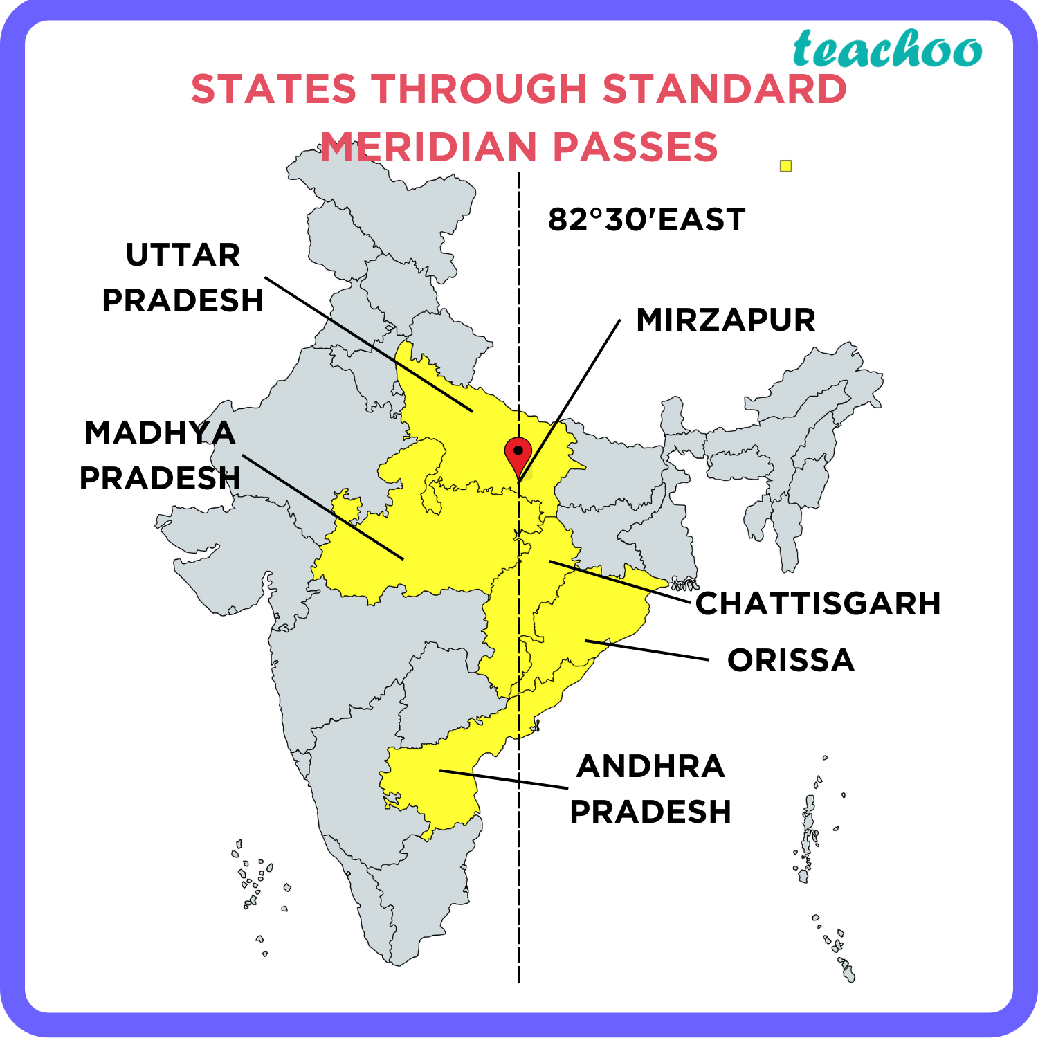
The Standard Meridian of India is located at 82°30′ East longitude. It passes near the town of Mirzapur in Uttar Pradesh. This place was selected because it lies almost in the middle of India, making it suitable for representing time for the entire country. The time calculated at this longitude is known as Indian Standard Time (IST).
Why India Needs a Standard Meridian
India stretches about 29 degrees of longitude from east to west. This means there is a time difference of almost two hours between the easternmost and westernmost parts of the country. For example, the sun rises much earlier in the east than in the west. If each region used its own local time, there would be confusion in railways, flights, offices, schools, and communication systems. Therefore, a single standard time based on one meridian is necessary for smooth functioning.
How IST is Calculated
The Earth rotates 360° in 24 hours, which means it rotates 15° in one hour. Therefore, each degree of longitude represents 4 minutes of time. The Standard Meridian of India at 82°30′E is 5 hours 30 minutes ahead of Greenwich Mean Time (GMT). Hence, IST = GMT + 5:30 hours.
Importance of the Standard Meridian
The Standard Meridian helps maintain uniform time across India. It is essential for:
Railway and airline schedules
Television and radio broadcasts
School and office timings
National and international communication
Scientific and meteorological observations
Without a standard time, every city would follow its own local time, leading to confusion and delays.
Historical Background
During British rule, different cities in India followed different local times. For example, Mumbai and Kolkata had their own time systems. In 1906, the Government of India officially adopted 82°30′E as the Standard Meridian and introduced Indian Standard Time for the entire country. Since then, IST has been used uniformly.
Conclusion
The Standard Meridian of India plays a vital role in keeping the country synchronized. By following 82°30′ East longitude, India maintains a single, uniform time system that supports national unity, efficient communication, and smooth daily life. It is a simple but powerful tool that helps a vast nation function as one.

Author: Gulsan_gautam
I am gulsan gautam.